
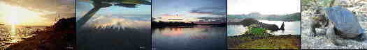
Tourism in El Oro
Tourism in El Oro
GR


Other provinces, cities and sites
Imbabura - Loja - Los Rios - Manabi - Morona Santiago - Napo - Orellana - Pastaza - Pichincha - Santa Elena
Tourism in the
El Oro Province
The El Oro province is in the Southwest of Ecuador on the border with Peru.
El Oro has 560,000 inhabitants, 420,000 urban and 140,000 rural.
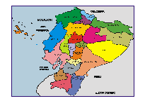
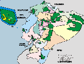
El Oro province has an area of 5,849 square kilometers divided into 14 cantons.
Huaquillas is the border city with Peru.

MUNICIPALITIES / CANTONS
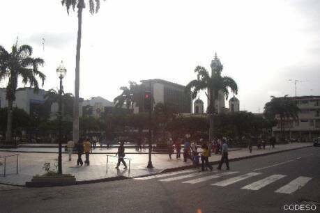
- Machala is the capital of the El Oro province and has 220,000 inhabitants. Machala is also known as the "Banana Capital of the World".
- Arenillas is in the south of Machala on the road to Huaquillas on the border.
Atahualpa
- Atahualpa is known for the Yacuviña Ruins, Cañari archaeological remains.
El Guabo
- El Guabo is in the north of Machala.
Huaquillas
- Huaquillas is on the border with Peru.
Marcabelí
Pasaje
- Pasaje is in the east of Machala on the road to Azoguez.
Piñas
- Piñas is in the southeast of Machala on the road to Loja. Piñas is famous for its orchids.
Santa Rosa
- Santa Rosa is south of Machala towards Huaquillas on the border.
Zaruma
- Zaruma queda en el suroriente de Machala cerca de Portovelo. Zaruma es una ciudad mágica por su arquitectura colonial.
Portovelo
- Portovelo is in the southeast of Machala on the highway to Loja. Portovelo is a gold mining production area.
Balsas
- Balsas is in the southeast of Machala on the road to Loja.
Chilla
Las Lajas
The Puyango Petrified Forest is an archaeological site located between the Provinces of El Oro and Loja, its petrified trees are approximately 100 million years old and it is the largest collection of petrified wood in the world.
The Arenillas Ecological Reserve has a surface area of 17,082 hectares, and was created on June 7, 2001.
The reserve is located 26 km from Sta Rosa and 60 km from Machala.
Restos incas de Yacuviña
Yacuviña is a housing complex from the Inca period that extends over about 100 hectares. A large number of archaeological pieces and human bones have been found in these ruins. The entire infrastructure resembles a lost city of the Incas, since the construction had aqueducts, cisterns and even bathrooms.
Mangrove Route
A special destination that has caught the attention of thousands of visitors is the "Manglar Route", cataloged as such because it covers important mangrove ecosystems of the Jambelí Archipelago, located between the Santa Rosa and Huaquillas cantons, with a length that reaches 43, 4 kilometers. The tour takes place in an area between Puerto Hualtaco, Los Conchales de Isla Seca, Isla Costa Rica and Isla San Gregorio.
This route is ideal for lovers of community, rural, nature and sun and beach tourism, as it combines the warm tropical climate of the coastal zone that fluctuates between 23º and 26º C, with activities ranging from artisanal fishing demonstrations and participation in the extraction of shells and crabs, going through the coexistence with the inhabitants of the communities of the islands, enjoying the blue and warm waters of the beaches, even the most exciting boat tours through the sea.
Fuentes: www.turismo.gob.ec
