Tourism in the province of Manabí
Tourism in Manabí
Tourism in Manabí
GR
The province of Manabí has 1,300,000 inhabitants, 660,000 urban and 620,000 rural.
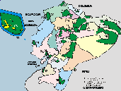
The province of Manabí has an area of almost 19,000 square kilometers, divided into 22 cantons.
Manabí has an important agricultural production in bananas, cocoa, coffee, and rice. There is also an important shrimp production.
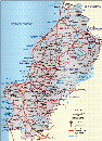
Manabí has the main tourist centers:
Puerto López with the Machalilla National Park, Puerto Cayo, Manta, Crucita, San Jacinto and San Clemente, Bahía de Caráquez, San Vicente, Jama, Canoa, Pedernales, each one with special characteristics that make them worth visiting.
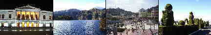
San Gregorio de Portoviejo is the provincial capital and is also the cantonal head of the canton of the same name. This city is the first city established on the Ecuadorian coast and was founded on March 12, 1535 by the Spanish Francisco Pacheco, who was a captain in the conquering army of Diego de Almagro.
It is indicated that the city of Portoviejo is founded with the name of Emperor Carlos V of Austria and I of Spain, the name of San Gregorio de Portoviejo is in homage to the great Pontiff of the Catholic Church.
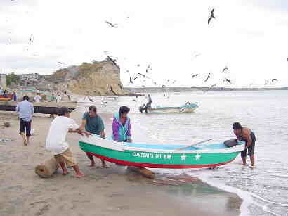
Pesca Artesanal en Jaramijo - Provincia Manabí


Otras provincias, ciudades y sitios
Imbabura - Loja - Los Rios - Manabi - Morona Santiago - Napo - Orellana - Pastaza - Pichincha - Santa Elena
Cámara de Turismo de Manabí
Teléfono: (593) 05- 263 5253
Alejo Lascano 114 y Pedro Gualñ Portoviejo
GOBIERNO DE LA PROVINCIA
Teléfono:


INTERESTING SITES
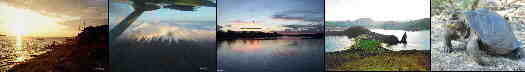
Puerto López is close to the Machalilla National Park and there is a beautiful beach here. From here the boats depart to the Isla de la Plata and the humpback whale watching tours.
The Isla de la Plata is in front of Puerto de Cayo, but there are also boats from Puerto López to the island. On the island there are some animals and plants like in the Galapagos Islands, for example the "Blue Legs". On the boat trip to the Isla de la Plata there is in season the possibility of observing humpback whales.
Machalilla National Park is in the province of Manabí near Puerto López on the Ecuadorian coast.
Manta is the main port of the Manabí Province and is located in the northwest near Portoviejo.
Portoviejo is the capital of the Manabí Province and has almost 200,000 inhabitants.
Bahía de Caráquez has a nice beach. It is reached by boat or by the bridge from San Vicente in the north of Portoviejo.
Crucita
Crucita is in the northwest near Portoviejo.
San Jacinto
San Jacinto is in the north of Rocafuerte.
San Clemente
San Clemente is near San Jacinto is in the north of Rocafuerte.
Pedernales
Pedernales is on the beach in the north of the province of Manabí.
Cojimíes
Cojimíes is a beach in the extreme north of the province of Manabí.
Puerto Cayo
Puerto Cayo is in the southwest of Portoviejo.
Los Frailes
Los Frailes has a beautiful secluded beach in the southwest of Portoviejo.
Montanita
Montanita has a beach and is in the southwest of Portoviejo in the province of Santa Elena.
Montecristi
Montecristi is between Portoviejo and Manta.